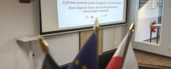
Research in progress as part of the Interreg Polska – Sachsen 2021-2027 project
Research in progress as part of the Interreg Polska – Sachsen 2021-2027 project
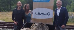
During the Summer, students of the Geodesy and Cartography program from the University of Science and Technology, under the scientific supervision of Dr. Jarosław Wajs, carried out terrestrial laser scanning (TLS) field measurements in the Geopark Muskauer Faltenbogen / Łuk Mużakowa. The 3D data collected during the fieldwork will enable the development of precise models of post-mining objects, representing an important step in documenting and preserving the region’s cultural and natural heritage.
The research is being conducted within the project “Digital journey through Muskau Arch Geopark” co-financed by the European Union through the European Regional Development Fund as part of the Poland-Saxony 2021-2027 INTERREG Cooperation Program.